Nanga Parbat Expedition: Trek to the Ninth Highest Mountain in the World and Mountain of Destiny
Tours
Table of Contents
Nanga Parbat stands as a massive peak in Pakistan that draws climbers from around the globe. This ninth-highest mountain in the world reaches 8,126 meters above sea level and offers tough routes for any expedition. Often called the naked mountain from Sanskrit words meaning just that, nanga parbat rises sharply in the Himalayan range. People know it as a killer mountain in Pakistan because of its steep faces and risks like avalanches or high altitude issues. For those planning a nanga parbat adventure, companies like K2 Trekking and Expedition provide options such as the nanga parbat base camp trek through fairy meadows nanga parbat areas. This lets visitors see stunning nanga parbat views without full summit attempts. The mountain sits near the Indus River and borders the Karakoram range with peaks like K2 nearby. Its location in the Gilgit-Baltistan region makes it a spot for both serious mountaineers and trekkers seeking killer mountain views.
Many stories surround nanga parbat expeditions over the years. Climbers face challenges on faces like diamir face nanga parbat or raikot face nanga parbat. The name nanga parbat is derived from ancient words and locals call it deo mir or diamir district terms. As one of the tallest mountains, nanga parbat is the westernmost major Himalayan peak. It grows fast too, earning spots in records as a growing mountain in the world. Whether aiming for the summit of nanga parbat or a base camp visit, this mountain of destiny tests every climber.
Why Choose K2 Trekking and Expedition for Your Nanga Parbat Adventure
When planning a trip to Nanga Parbat, picking the right team makes all the difference. K2 Trekking and Expedition stands out with years of handling treks in Pakistan’s tough terrain. They know the routes inside out from Raikot Bridge to Fairy Meadows and base camp. Their guides spot risks like changing weather or rough paths and keep groups safe every step.
K2 Trekking and Expedition offers fixed departures with clear prices starting at $1,250 per person. You get full support including jeeps, porters and camps without hidden fees. The 9-day itinerary builds in rest days for altitude adjustment so you enjoy the views not fight fatigue. Past trekkers rave about the smooth logistics from Islamabad pickup to airport drop.
What sets K2 Trekking and Expedition apart is their local ties in Gilgit-Baltistan. Offices in Skardu and Islamabad mean quick help if needed. They focus on small groups for personal attention and share real stories of the Killer Mountain. Book with them to turn your Nanga Parbat dream into a memorable reality. Contact at +92 342 8394603 or info@k2trekkingandexpedition.com to start.

Location and Geography of Nanga Parbat
Nanga Parbat in Which Country
Nanga parbat lies fully within Pakistan and draws attention as a key peak in the region. This highest mountain sits in the Gilgit-Baltistan area under Pakistan administration and borders Kashmir zones. Climbers often start their nanga parbat expedition from Islamabad and head north to reach base camps. The peak marks the end of the Himalayas on its west side and stands south of the Indus River in the Diamer district. Locals know it as diamir or deo mir and see it as a huge mountain rising alone. For visitors, Pakistan’s control means permits come through local offices for any ascent of nanga parbat. The area offers views of glaciers and valleys that make nanga parbat a spot for adventure.
Pakistan hosts nanga parbat as part of its northern treasures alongside peaks like K2 in the Karakoram. The mountain’s position makes it accessible from roads near the Indus River and porters from nearby villages help with gear. Nanga parbat’s location adds to its fame as a killer mountain in Pakistan with routes starting from valleys like Diamir or Raikot.
Nanga Parbat Is Located in Which Mountain Range
Nanga parbat belongs to the Himalayas and acts as its western anchor point. This range stretches across Asia but nanga parbat ends it near the Indus River bend. Close to the Karakoram range with giants like K2, nanga parbat stands out as a Himalayan peak. The mountain rises far above its surrounding terrain and creates dramatic drops to valleys below. Known locally as diamer or deo mir, nanga parbat is the westernmost eight-thousander in this system. Climbers note how it separates from other tall peaks and offers unique routes.
The Himalayas hold nanga parbat as their edge before the Karakoram begins. This spot south of the Indus River in the Diamer district gives it isolation. Nanga parbat is also one of the 14 peaks over 8,000 meters and draws expeditions for its challenges. The range’s features include glaciers on nanga parbat’s sides and steep faces like the Rupal face. Mountaineers compare it to Nepal’s peaks like Mount Everest but nanga parbat stays in Pakistan’s territory.
Nanga parbat links to the broader Himalayan chain yet feels remote. Its position makes it a fastest growing mountain too with uplift from tectonic forces. Expeditions often highlight how nanga parbat towers over the landscape and creates its own weather patterns.
Nanga Parbat Height
Nanga parbat reaches 8,126 meters or 26,660 feet above sea level. This makes it the ninth highest mountain in the world among the tallest mountains. Climbers face high altitude issues here like pulmonary edema during ascents. The peak’s prominence stands at 4,608 meters and ranks high globally.
Nanga Parbat Valley
Valleys around nanga parbat add to its appeal for treks and climbs. The Rupal valley on the south face offers views of the highest mountain face in the world at 4,600 meters rise. Herders use this area in summer and base camps set up here for Rupal routes. To the west, Diamir valley leads to the Diamir face with its glacier flows. Porters from local spots carry loads to camps amid rocky terrain. North lies the Raikot valley with access to fairy meadows nanga parbat for stunning nanga parbat fairy meadows spots. Trekkers reach these via jeep from Raikot bridge and hike up.
Nanga parbat valleys hold glaciers like the Diamir glacier that feed into the Indus River in the Diamer district. The Astore valley nearby connects to other paths. Nanga parbat is known locally for these features and draws people for nanga parbat views. The south face overlooks Rupal with its steep wall while east sides show raikot face nanga parbat. Expeditions use these valleys as starting points from Islamabad drives.
In Diamer district south of the Indus River, valleys provide routes for nanga parbat adventure. The name diamer or deo mir reflects local views of this huge peak. Glaciers carve deep paths and create risks like avalanches for climbers.
| Feature | Height | Location | Nearby Peaks |
|---|---|---|---|
| Summit | 8,126 m | Gilgit-Baltistan, Pakistan | K2 (8,611 m) in Karakoram |
| Rupal Face | 4,600 m rise | South side | None immediate |
| Prominence | 4,608 m | Western Himalayas | Mount Everest (8,848 m) |
| Base Elevation | Around 3,500 m | Diamer District | Rakhiot Peak (7,070 m) |
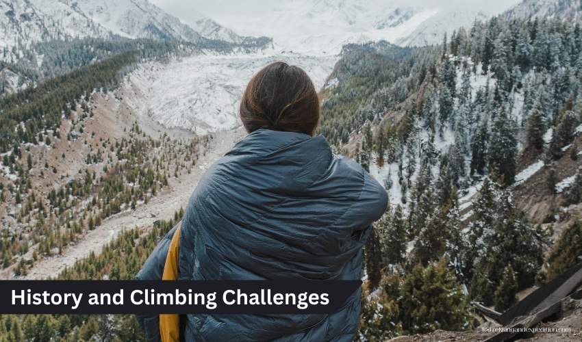
History and Climbing Challenges
Why Nanga Parbat Is Called Killer Mountain
Nanga parbat earned the nickname killer mountain from its deadly history full of avalanches and bad weather. Early expeditions lost many lives on this peak before anyone summited nanga parbat. In the 1930s, German teams faced storms that killed climbers and porters alike. The mountain’s steep faces like the south face trap people in harsh conditions at high altitude. Nanga parbat is also known for fast changes in weather that lead to disasters. This ninth highest peak demands respect as a mountain of destiny where many failed to reach the summit.
Climbers call nanga parbat the killer mountain because of events like the 1937 avalanche that took 16 lives. The peak’s isolation adds risks with no quick rescue. Hermann Buhl first climbed it in 1953 via the Raikot face but others died trying similar paths. Winter ascent of nanga parbat proved even harder with cold and wind. Recent tales include the 2013 Taliban attack at base camp that killed 11. Nanga parbat’s reputation as killer mountain pakistan comes from these stories over decades.
Despite dangers, nanga parbat draws expeditions led by bold mountaineers. The name diamir face route saw tragedies but also successes like Reinhold Messner’s solo in 1978. Bad weather often stops summit attempts and causes high altitude pulmonary edema. Nanga parbat is the westernmost Himalayan giant and its challenges keep the killer label alive.
Nanga Parbat Deaths
Deaths on nanga parbat number over 80 since early attempts making it a true killer mountain. In 1895, Albert Mummery and two others vanished on the Raikot face. The 1934 storm claimed 9 including leader Willy Merkl from exhaustion and frostbite. Three years later, an avalanche killed 7 Germans and 9 support staff. These early losses set nanga parbat’s grim record. During the 1970 Rupal face climb, Günther Messner died in an avalanche after summiting with brother Reinhold.
More recent deaths hit nanga parbat hard like the 2013 attack at Diamir base camp killing 11 climbers. In 2008, Karl Unterkircher fell into a crevasse on the Raikot face. Go Mi-Young slipped on descent in 2009 after her summit. Winter tries saw Tomasz Mackiewicz die in 2018 from cold and sickness. Daniele Nardi and Tom Ballard went missing in 2019 with bodies later found. In 2025, Klara Kolouchova fell above camp 2. Avalanche and falls cause many losses on this peak.
Nanga parbat deaths often stem from its steep terrain and weather. High altitude claims lives through edema or heart issues. Porters and Sherpas faced risks too in early expeditions. The mountain’s faces like Diamir hold serac threats that bury camps. Despite safer gear now, nanga parbat remains deadly for those seeking its summit.
Nanga Parbat Pronunciation
Nanga parbat gets said as nang-guh par-bat in English with stress on the first syllables. Locals in Pakistan use dee-ah-meer for its other name. The Sanskrit roots give it a flow like nung-gah pur-vut but common use simplifies it.
| Year | Key Climbers | Outcome |
|---|---|---|
| 1895 | Albert Mummery | Died reconnoitering Raikot face |
| 1934 | Willy Merkl | 9 deaths in storm |
| 1937 | Karl Wien | 16 killed by avalanche |
| 1953 | Hermann Buhl | First ascent via Raikot flank |
| 1962 | Toni Kinshofer, Siegfried Löw | Second ascent via Diamir face |
| 1970 | Reinhold and Günther Messner | Rupal face ascent; Günther died |
| 1978 | Reinhold Messner | First solo ascent via Diamir |
| 2016 | Simone Moro, Alex Txikon, Ali Sadpara | First winter ascent |
| 2025 | David Göttler, Tiphaine Duperier, Boris Langenstein | Alpine-style Rupal with ski/paraglide descent |
Faces and Routes of Nanga Parbat
Diamir Face Nanga Parbat
The diamir face nanga parbat offers the most common route for climbers seeking to climb nanga parbat. This west side starts from Diamir valley and uses the Kinshofer route on the diamir face. First climbed in 1962 by a German team, it avoids big seracs but still faces avalanche risks. Expeditions set camps along the buttress to reach the summit of nanga parbat. Reinhold Messner made history here with his solo in 1978 without oxygen. The face rises sharply from base camp and demands fixed ropes for safety.
Diamir face nanga parbat suits those on nanga parbat expedition with its shorter approach from Islamabad. Porters help carry to herrligkoffer base camp at around 4,200 meters. Climbers deal with high altitude and bad weather on this side of the diamir. The route on the diamir face passes glaciers and ice walls before the final ridge. Winter ascent of nanga parbat often uses this face like the 2016 team. In 2025, Denis Urubko and Maria Cardell opened a new path here in alpine style.
Mountaineers value diamir face for its views over the Indus River. As nanga parbat’s west wall, it stands as a challenge among eight-thousanders. Expeditions led to successes but also deaths from falls or storms.
Raikot Face Nanga Parbat
Raikot face nanga parbat provides access for the nanga parbat trek and base camp visits. This north side features the Rakhiot glacier and leads to fairy meadows nanga parbat. Hermann Buhl used this flank for his 1953 first ascent of nanga parbat via the east ridge. The face has subsidiary peaks like Rakhiot Peak at 7,070 meters. Trekkers enjoy nanga parbat fairy meadows as a spot for killer mountain views without full climb.
For a nanga parbat adventure, K2 Trekking and Expedition runs the nanga parbat base camp trek on this side. Start from Raikot bridge by jeep to Tato then hike to meadows. The raikot face nanga parbat shows silver plateau and crags. Early attempts here saw tragedies like the 1930s German losses. Fewer summit bids use it now due to long exposure but it suits base camp goals.
The face drops to the Indus River and offers dramatic nanga parbat views. Climbers note its avalanche prone areas and need careful planning.
| Face | Difficulty Level | Access Points | Views |
|---|---|---|---|
| Diamir | High, technical with seracs | Diamir Valley from Chilas | Glaciers, Indus River |
| Raikot | Moderate for trek, high for summit | Raikot Bridge to Fairy Meadows | Fairy Meadows, Rakhiot Glacier, killer mountain pakistan panoramas |
Nanga Parbat Trek and Adventure Options
Nanga Parbat Trek
The nanga parbat trek draws people to Pakistan’s north for its mix of challenge and beauty. Starting from Islamabad, trekkers drive through hilly roads to reach spots like Naran before heading to Raikot Bridge. From there, jeeps take over on rough tracks to Tato village and then a hike leads to fairy meadows nanga parbat. This path offers glimpses of the killer mountain pakistan as it looms ahead. Companies like K2 Trekking and Expedition organize these trips with porters to carry gear and set up camps. The trek suits those fit enough for daily walks of 6-7 hours amid rising altitude.
On the nanga parbat trek, days build up with drives and hikes that test stamina. After Naran at around 2,400 meters, the jeep ride to Tato climbs to 2,900 meters or so. The walk to fairy meadows nanga parbat hits 3,300 meters with views of raikot face nanga parbat. Trekkers spot glaciers along the way and hear stories of past expeditions. The name nanga parbat comes from Sanskrit for naked mountain and fits its bare rocky sides. This adventure lets folks see the himalayan giant without a full climb.
Many choose the nanga parbat trek for its access to base camp. The route follows the indus river at first then turns into valleys like diamir. Mountaineers use similar paths for nanga parbat expedition starts but trekkers stop at scenic points. With risks like avalanche in mind, groups stick to marked trails. The trek wraps back the same way and ends in Islamabad after 9 days total.
Nanga Parbat Base Camp
Reaching nanga parbat base camp marks the highlight for many on this journey. From fairy meadows nanga parbat, the hike to base camp takes 6-7 hours over rocky ground and past beyal camp. At around 3,850 meters, the camp sits below the raikot face nanga parbat with clear sights of the peak’s glaciers. Climbers set up here for ascent of nanga parbat attempts like hermann buhl did in 1953. For trekkers, it’s a spot to rest and take in the ninth highest mountain in the world.
The nanga parbat base camp area holds tents and supplies brought by porters. An acclimatization day helps adjust to high altitude and avoid issues like pulmonary edema. Short walks around show the diamir glacier flows and the indus river far below. This base camp on the raikot side differs from diamir face nanga parbat ones used for kinshofer route climbs. Expeditions led here focus on safety with no use of supplemental oxygen for casual visitors.
Stories from nanga parbat base camp include winter ascent of nanga parbat tales. The spot named herrligkoffer base camp honors early expedition leaders. Trekkers enjoy the quiet broken by ice cracks and feel the mountain of destiny vibe. Backtracking to fairy meadows nanga parbat completes the loop with overnight camps under stars.
Fairy Meadows Nanga Parbat
Fairy meadows nanga parbat serves as a key stop on the trek with its grassy fields at 3,300 meters. Reached after a jeep from raikot bridge and a 2-3 hour hike from tato, this meadow offers first close nanga parbat views. Tents dot the area amid pine trees and locals run small huts for food. The spot got its name from old tales and fits the peaceful setting below the killer mountain pakistan.
In fairy meadows nanga parbat, nights bring clear skies for stargazing and days allow easy walks to viewpoints. The raikot face nanga parbat dominates the horizon with its steep rise. Trekkers use this as a base before pushing to nanga parbat base camp. Known locally as a heaven on earth, it draws crowds in summer for nanga parbat fairy meadows photos. The access road can close due to bad weather but jeeps handle the rough parts.
Fairy meadows nanga parbat connects to broader himalayan trails near karakoram peaks like k2. Visitors spot wildlife and flowers in season. The meadow’s isolation adds to the nanga parbat adventure feel far from cities like islamabad.
Nanga Parbat Fairy Meadows
Nanga parbat fairy meadows blend green pastures with snowy peaks for a striking scene. This area south of the indus river in diamer district lets trekkers camp comfortably before tougher hikes. The name diamer or deo mir reflects local views of nanga parbat as a huge presence. At 3,300 meters, it’s a spot to adjust altitude and enjoy killer mountain views without summit bids.
The nanga parbat fairy meadows path starts with drives from islamabad to naran then to raikot bridge. Jeeps climb to tato at 2,900 meters and hikes follow to the meadows. Porters help with loads amid the growing mountain in the world uplift. This westernmost himalayan site offers rest days with optional strolls to see glaciers. Nanga parbat fairy meadows hold cabins and camps for overnight stays. The views rival any in pakistan’s gilgit-baltistan region of pakistan-administered kashmir.
Nanga Parbat Adventure
A nanga parbat adventure ranges from treks to full climbs on this 9th highest mountain. Options include the base camp route via fairy meadows nanga parbat for less experienced folks. Start in islamabad and drive north to experience the himalayas end near karakoram.
In a nanga parbat adventure, risks like avalanche or bad weather add thrill. Climbers aim for summit of nanga parbat via diamir face but trekkers stick to safer paths. K2 Trekking and Expedition handles logistics with guides and gear. The nanga parbat adventure tests limits in pakistan’s wild north.
| Day | Activities | Altitude |
|---|---|---|
| 1 | Arrive Islamabad, hotel briefing and gear check | 500 m |
| 2 | Drive to Naran, overnight guesthouse | 2,400 m |
| 3 | Drive to Raikot Bridge, jeep to Tato, trek to Fairy Meadows, camping | 3,300 m |
| 4 | Trek to Nanga Parbat Base Camp, camping | 3,850 m |
| 5 | Acclimatization at Base Camp, optional hikes, camping | 3,850 m |
| 6 | Trek back to Fairy Meadows, camping | 3,300 m |
| 7 | Trek to Tato, jeep to Raikot Bridge, drive to Naran, guesthouse | 2,400 m |
| 8 | Drive to Islamabad, free time, hotel | 500 m |
| 9 | Airport transfer, departure | 500 m |
Views and Scenic Attractions
Nanga Parbat Views
Nanga parbat views stun from various points along the trek. From fairy meadows nanga parbat, the peak fills the sky with its white summit against blue. Glaciers like rakhiot hang down the sides and create a dramatic drop. The rupal face shows as the highest mountain face in the world from south valleys. Trekkers capture these at dawn when light hits the ice.
Nanga parbat views change with the hike to base camp. Closer up, details emerge like cracks in the diamir glacier. The indus river winds below in diamer district and adds depth. This naked mountain from sanskrit words parvata and nagna stands alone far above its surrounding terrain. Evening nanga parbat views glow pink from sunset and make the spot feel magical. The one of the 14 tallest mountains offers panoramas that reward the effort.
Killer Mountain Views
Killer mountain views refer to nanga parbat’s fierce look from afar. The steep diamir face nanga parbat shows seracs ready to fall and earns the earned the nickname killer mountain. From raikot bridge, the full height appears massive over the indus river.
These killer mountain views impress at fairy meadows nanga parbat with the raikot face nanga parbat in focus. Glaciers flow down and avalanches rumble now and then. Climbers on expedition to nanga parbat spot routes from here. Killer mountain views highlight why first climbed in 1953 took so long. The south face overlooks rupal valley with its huge wall.
Killer Mountain Pakistan
Killer mountain pakistan points to nanga parbat’s spot in the country’s north. This himalayan peak in gilgit-baltistan draws global eyes for its dangers and beauty. Known locally as diamir, it sits south of the indus river in the diamer district.
Killer mountain pakistan stories fill books from early alpine club tries to modern summits. Nepal has mount everest but pakistan holds this giant.
| Vantage Point | Description of Visible Features |
|---|---|
| Fairy Meadows | Broad panoramas of raikot face nanga parbat, rakhiot glacier, green fields foreground, distant indus river |
| Base Camp | Close-up of glaciers like diamir glacier, ice walls, summit ridge, surrounding peaks in himalayas |
Frequently Asked Questions
1. Where is Nanga Parbat located?
Nanga Parbat sits in the Gilgit-Baltistan region of Pakistan. It lies south of the Indus River in the Diamer district. This peak marks the western end of the Himalayas. Locals know it as Diamir and it towers over nearby valleys.
2. Why is Nanga Parbat called the Killer Mountain?
Nanga Parbat earned the Killer Mountain name from many deadly accidents. Avalanches and bad weather claimed dozens of lives in early expeditions. Over 80 deaths happened before and after the first ascent. The steep faces add huge risks even today.
3. Is Nanga Parbat hard to climb?
Yes Nanga Parbat ranks as one of the hardest eight-thousanders. Its giant faces like the Rupal wall demand top skills. Weather changes fast and avalanches hit often. Even strong climbers face serious challenges here.
4. What is the height of Nanga Parbat?
Nanga Parbat reaches 8,126 meters above sea level. This makes it the ninth highest mountain on earth. The peak rises sharply from valleys below. Its prominence stands out among tall peaks.
5. Why is Nanga Parbat called so?
The name Nanga Parbat is derived from the Sanskrit words nagna and parvata meaning naked mountain. It fits the bare rocky look of the peak. Nanga Parbat also carries local names like Diamir. Sanskrit words nagna and parvata describe its exposed sides.
6. How long is the Nanga Parbat Base Camp trek?
The Nanga Parbat Base Camp trek lasts 9 days total. It includes drives from Islamabad and hikes to Fairy Meadows. Days at base camp allow rest and views. The return follows the same path.
7. What is the best time to trek to Nanga Parbat Base Camp?
Summer months from June to September work best for the trek. July and August bring stable weather and open roads. Snow closes paths in winter. Clear skies help spot the peak.
8. How to reach Fairy Meadows for Nanga Parbat trek?
Start from Islamabad and drive to Raikot Bridge. Take a jeep to Tato village then hike 2-3 hours up. The trail climbs through pines to Fairy Meadows. Porters carry heavy bags on this section.
9. Is Nanga Parbat in the Himalayas or Karakoram?
Nanga Parbat belongs to the Himalayas as its westernmost major peak. It sits near the Karakoram range but stays in the Himalayan chain. The Indus River bend separates the two ranges.
10. Who was the first to climb Nanga Parbat?
Hermann Buhl from Austria made the first ascent in 1953. He climbed solo on the final push without oxygen. The route went via the Diamir face area. No Sherpa joined that historic summit.
Conclusion
Nanga parbat wraps up as a peak full of history and allure in pakistan. From its height as ninth highest to the faces like rupal face or diamir, it challenges all who come. Treks to nanga parbat base camp via fairy meadows nanga parbat offer safe ways to see the killer mountain pakistan up close. Views from these spots show glaciers and valleys that define the himalayas. Adventures here test climbers on routes first climbed decades ago with sherpas and porters aiding.
The nanga parbat expedition spirit lives on with successes like reinhold messner or hermann buhl. Yet deaths from avalanche or high altitude remind of risks. This mountain is known locally as deo mir and grows as the fastest growing mountain. For those seeking nanga parbat trek options, K2 Trekking and Expedition provides set departures.

You may also like

K2 Base Camp Trek
Book K2 base camp trek- 2023-24 with the No.1 Native k2 Trekking Company of Karakoram Pakistan in affordable prices. why to pay a heap to an agent, when we offer the same in just $1,850. Trek to k2 base camp is a....

K2 Gondogoro La Trek
The trek starts from Skardu, then to Shigar valley until Ali camp and cross the Gondogoro pass into Hushe valley and back to Skardu city in a circular way that is why it is also known as K2 Gondogoro La Circuit.K2 Gondogoro…….

Khosar Gang Expedition
Khosar Gang Expedition (6000m) provides a panoramic view of the Karakoram mountains from the summit. you can view K2, Broad Peak, Rakaposhi, Spantik 7027m, Nanga Parbat 8000m, and hundreds of above ....

luxury Skardu Honeymoon Tour Packages By Air
Chogori Adventure the leading Native Tour operator of Skardu valley, offers 3 Days, 4 Days, 5 Days, 7 Days by air Skardu Honeymoon tour package..